Details
All Walks
?
Export
More Details

Walla Crag Walk

Details
Walla Crag Walk
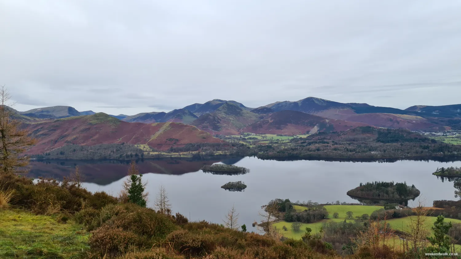
Derwentwater from Walla Crag

Walla Crag Circular Walk

Ah, this Walla Crag walk—starting from Keswick and looping back via Derwentwater—is a classic.

You start off from Keswick, right in the heart of the Lake District. It's all bustling streets and cozy vibes, but once you hit the trail towards Walla Crag, it's like stepping into a whole different world. There is some free parking available where this walk starts.

The climb up from Keswick to Walla Crag isn't too bad, actually. It's a steady incline, nothing too strenuous, and the views just keep getting better as you go. You can see Keswick below, nestled by Derwentwater, and as you gain height on the Walla Crag circular walk, the whole Lake District panorama unfolds before you.

Once you hit the top of Walla Crag, it's like a reward for your efforts. The view is just breathtaking—mountains, valleys, and that shimmering expanse of Derwentwater below. It's the kind of view that makes you feel small in the best possible way.

Heading back down, you can take a leisurely stroll along the shores of Derwentwater. It's all peaceful and serene, with the water lapping gently against the shore and maybe some ducks paddling by. And the best part? You can stop off for a well-deserved ice cream in Keswick when you're done. Perfect end to a perfect Walla Crag circular walk.

?
Export
Details
Route Type
Circular
Difficulty
Moderate
Under Foot
Mixed Paths
Car Parking
Free Parking
Key Features
Circular Walk<br />Forests & Woodlands<br />Lakes<br />Mountains<br />National Trail<br />National Trust<br />Pubs on Route<br />Rivers<br />Roads<br />Summit Route<br />Wainwright Fells<br />Wildflowers<br />Wildlife<br />
Summits
  • Walla Crag
Points of Interest
  • Walla Crag
  • Derwentwater
  • Ashness Bridge
Hill Bagging
Wainwrights<br />Birketts<br />
Refreshments & Facilities
  • Keswick has plenty places refreshments
More Info

Wainwright on Walla Crag Walks

In his Pictorial Guide to the Lakeland Fells, Alfred Wainwright noted that Walla Crag was noted as 'Wallow Crag' on old editions of Ordnance Survey maps. He goes on to sing its praises, stating it is "of moderate elevation yet steep, romantic, challenging". The Wainwright quote on Walla Crag follows in full:

The pleasant Vale of Keswick, surely one of earth's sweetest landscapes, is surrounded by mountains of noble proportions with an inner circle of lesser fells which deserve more than the name of foothills, each having strong individual characteristics, a definite all its own. Among these is Walla Crag, an eminence of intermingled rocks and trees overlooking the east shore of lovely Derwentwater: of moderate elevation yet steep, romantic, challenging. Seen from the lake the hoary top seems unattainable, yet it may be gained by the gentlest of ascents for the slopes beyond the upper fringe of crag descend easily accompanied by Brockle Beck, almost to the streets of Keswick.
— Alfred Wainwright

Wainwright goes on to provide a Walla Crag walking route from Keswick and another from Borrowdale Road.

Walla Crag Summit

The summit of Walla Crag is a favourite of many, including Wainwright. He writes that Walla Crag is a "delectable place for a picnic, the heathery top of Walla Crag is also a favourite viewpoint for Derwentwater, seen directly below the long steep escarpment."

As well as Derwentwater below, you can enjoy views in all directions from the summit of Walla Crag. The mountain view stretches across to Ullock Pike, Skiddaw and Blencathra in the north, Catbells to the west and the tip of High Seat in the south, as well as countless others.

More Details

Llanthony Priory Walk

Details
Llanthony Priory Walk
Llanthony Priory

Llanthony Priory Walk - Circular

So, starting off from Llanthony Priory, the walk kicks off with a steady climb towards Hatterrall Hill. The priory ruins kind of set the mood—quiet and mysterious, you know? Like you're stepping back in time.

As we make our way up, the views start peeking through the trees, giving us a taste of what's to come. And man, when you hit the top of Hatterrall Hill, it's like a whole new world opens up. You can see for miles, just you and the hills.

Heading down into Llanthony Wood, it's all about those dappled sunbeams and ancient trees. It's like something out of a fairy tale, especially when you stumble upon those hidden clearings.

And finally, we circle back to Llanthony Priory, where time feels like it's standing still. It's a nice full circle, you know? Reminds you how timeless and beautiful this place really is.

?
Export
Details
Route Type
Circular
Difficulty
Moderate
Under Foot
Mostly Good Paths
Car Parking
Free Parking
Key Features
Circular Walk<br />Cultural/Historical Interest<br />Forests & Woodlands<br />Summit Route<br />Wildflowers<br />Wildlife<br />
Summits
  • Hatterrall Hill
Points of Interest
  • Llanthony Priory
Refreshments & Facilities
  • Cafe at Llanthony Priory
More Details

Mynydd Troed Walk

Details
Mynydd Troed Walk
Mynydd Troed Trig Point with Pen Y Fan in Distance

Mynydd Troed Circular Walk

Mynydd Troed is a prominent hill in the Brecon Beacons National Park in Wales, offering stunning views and a relatively easy climb for hikers of all levels.

Starting from the Dinas Castel Inn car park in Pengenffordd, the walk begins with a gentle ascent through fields and woodlands, gradually leading to more open terrain as you approach the summit. Along the way, you may encounter grazing sheep and wild ponies, adding to the picturesque scenery.

Mynydd Troed Summit

Once at the summit of Mynydd Troed, the panoramic views stretch across the surrounding countryside, including nearby peaks like Pen y Fan and the Black Mountains.

It's an ideal outing for nature lovers and those seeking a rewarding hike without too much difficulty. The way back is a little less interesting than the way up to the summit, so you may even like to explore some of the other possible routes of Mynydd Troed.

?
Export
Details
Route Type
Circular
Difficulty
Moderate
Under Foot
Mostly Natural
Car Parking
Ticketed Parking
Key Features
Circular Walk<br />Mountains<br />Pubs on Route<br />Roads<br />Summit Route<br />Wildflowers<br />Wildlife<br />
Summits
  • Mynydd Troed - 609 m (1,998 ft)
Refreshments & Facilities
  • Castel Dinas Inn
More Info

Mynydd Troed Car Park

The best place to park for the Mynydd Troed walk is the Dinas Castel Inn car park, which is located at the start point of this walk. There is an honesty box for paying to use the car park so take a few coins with you. The car park for Mynydd Troed can be very busy as it is a popular spot for many hiking routes (such as walking Waun Fach & Dragons Back), so get there early to secure a spot.

More Details

Hay Bluff Walk

Details
Hay Bluff Walk
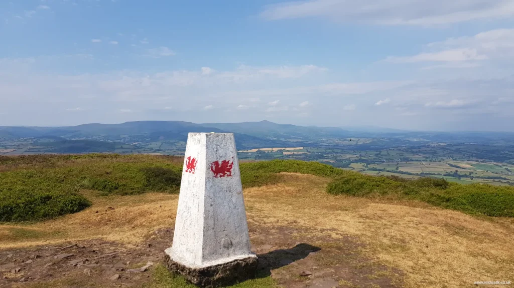
Hay Bluff Trig Point

Hay Bluff Circular Walk

Hay Bluff is a prominent peak on the edge of the Black Mountains in Wales. At just over 10 km in length, and with a fairly steep ascent of over 400 metres, this Hay Bluff walk is a good challenge for all, without being too daunting. On this walk, you'll enjoy stunning views of the surrounding countryside and the rugged beauty of its landscape.

Throughout the walk, you will almost certainly encounter wild ponies grazing on the grassy slopes, adding to the scenic charm of the area.

Hay Bluff & Lord Hereford's Knob

Starting at Hay Bluff car park, this walk starts by heading south west and and sweeping around and up Lord Hereford's Knob (or Twmpa in Welsh). Following this route, you can see Pen-Y-Fan in the distance past Lord Hereford's Knob, which makes for a stunning view.

The steep climb up Lord Hereford's Knob is the toughest part of this walk, but once you reach the summit, you're rewarded with breathtaking panoramic views stretching out in every direction. You can see for miles across the Welsh and English countryside, with the peaks of the Brecon Beacons rising in the distance. Lord Hereford's Knob summit is 690 m (2,260 ft), making this the highest point on this walk.

Hay Bluff Summit

From Lord Hereford's Knob, it's a lot easier on the knees, with a slight decline before a steadier climb back up to the summit of Hay Bluff. The Hay Bluff summit is 677 m (2,221 ft), slightly less than Lord Hereford's Knob. The path meanders through heather-covered moorland and rocky outcrops, offering hikers a chance to immerse themselves in the untamed beauty of the Black Mountains.

You'll be able to see the Hay Bluff Car Park from the summit, and there is a steep direct path back down if you're done for the day. However, this Hay Bluff walking route instead joins Offa's Dyke path for a much more pleasant steady walk back to the car park.

Overall, this Hay Bluff and Lord Hereford's Knob walk is a rewarding experience, offering a chance to explore some of the most picturesque scenery that Wales has to offer.

Hay Bluff Car Park

Hay Bluff Car Park is located right by Hay Bluff itself. Getting there from Hay-on-Wye is quite straightforward, however the road is single track for large parts. If coming from Hay-on-Wye, it's only a few miles, but if you're coming from Abergavenny, it's a long stretch of single tracked roads.


?
Export
Details
Route Type
Circular
Difficulty
Moderate
Under Foot
Mostly Natural
Car Parking
Free Parking
Key Features
Circular Walk<br />Mountains<br />National Trail<br />Summit Route<br />Wildflowers<br />Wildlife<br />
Summits
  • Hay Bluff - 677 m (2,221 ft)
  • Lord Hereford's Knobb - 690 m (2,260 ft)


Points of Interest
  • Hay Bluff Trig Point
Hill Bagging
Trig Points<br />Nuttals<br />Hewitts<br />
Refreshments & Facilities
  • None
More Details

Woodchester Park Walk from Coaley Peak

Details
Woodchester Park Walk from Coaley Peak
Coaley Peak View

Woodchester Park Walk from Coaley Peak

Enjoy this fairly simple Woodchester Park walk from Coaley Peak. Breathe in the fresh air in the woodland areas and by the ponds, perfect for restoring yourself at the weekend.

Parking at Coaley Peak is perfect if you aren't a National Trust member. And it's also a great way to incorporate the great views from Coaley Peak into your walk around Woodchester Park.

The paths can be incredibly muddy in winter, so make sure you're wearing suitable footwear.

?
Export
Details
Route Type
Circular
Difficulty
Easy
Under Foot
Mostly Natural
Car Parking
Free Parking
Key Features
Circular Walk<br />Forests & Woodlands<br />National Trust<br />Wildflowers<br />Wildlife<br />
Points of Interest
  • Woodchester Park
  • Coaley Peak
  • Nympsfield Longbarrow
More Details

The Blorenge Circular Walk

Details
The Blorenge Circular Walk
start point blorenge walk

With a steep decline and a couple of steady inclines, this is a great and moderately difficult walking route of The Blorenge.

This Blorenge walk starts from Keepers Pond (or Pen-Ffordd-Goch Pond). One of two beautiful ponds you'll see on this walk.

The first section is straightforward, with mostly good paths. But after a fairly easy climb to the summit, you will be presented with a steep decline that is tough on the knees. Once done, it's a steady but steep incline back through beautiful countryside and a final stretch of road walking back to the start point.

?
Export
Details
Route Type
Circular
Difficulty
Moderate
Under Foot
Mixed Paths
Car Parking
Free Parking
Key Features
Circular Walk<br />Forests & Woodlands<br />Mountains<br />Summit Route<br />Wildflowers<br />Wildlife<br />
Summits
  • The Blorenge
Points of Interest
  • The Blorenge
  • Keepers Pond (or Pen-Ffordd-Goch Pond)
Hill Bagging
Trig Points<br />
More Details

Walking the Cotswold Way

Details
Walking the Cotswold Way
View from Cotswold Way

Cotswold Way Walking Route

The Cotswold Way is one of the nation's most loved and most walked national trails. And that's for good reason. This famous 102-mile trail winds through rolling hills, quaint villages, and past ancient landmarks, making it the perfect walk for both avid hikers and those seeking a peaceful escape.

Walking the Cotswold Way is an adventure steeped in both natural beauty and historical significance, offering a journey through the heart of England's picturesque countryside.

When walking the Cotswold Way, you will explore its stunning landscapes, rich history, and the unique experiences it offers. From the charming streets of Chipping Campden to the historic splendor of Bath, every step promises a new discovery. Whether you're planning your hike or simply dreaming of the English countryside, find out everything you need to know about the Cotswold Way route here.

?
Export
Details
Route Type
Linear
Difficulty
Hard
Under Foot
Mostly Good Paths
Car Parking
None
Key Features
Cultural/Historical Interest<br />Forests & Woodlands<br />Lakes<br />Linear Walk<br />National Trail<br />National Trust<br />Pubs on Route<br />Rivers<br />Roads<br />Wildflowers<br />Wildlife<br />
More Details

Tintern Abbey to Devil’s Pulpit – Circular Walk

Details
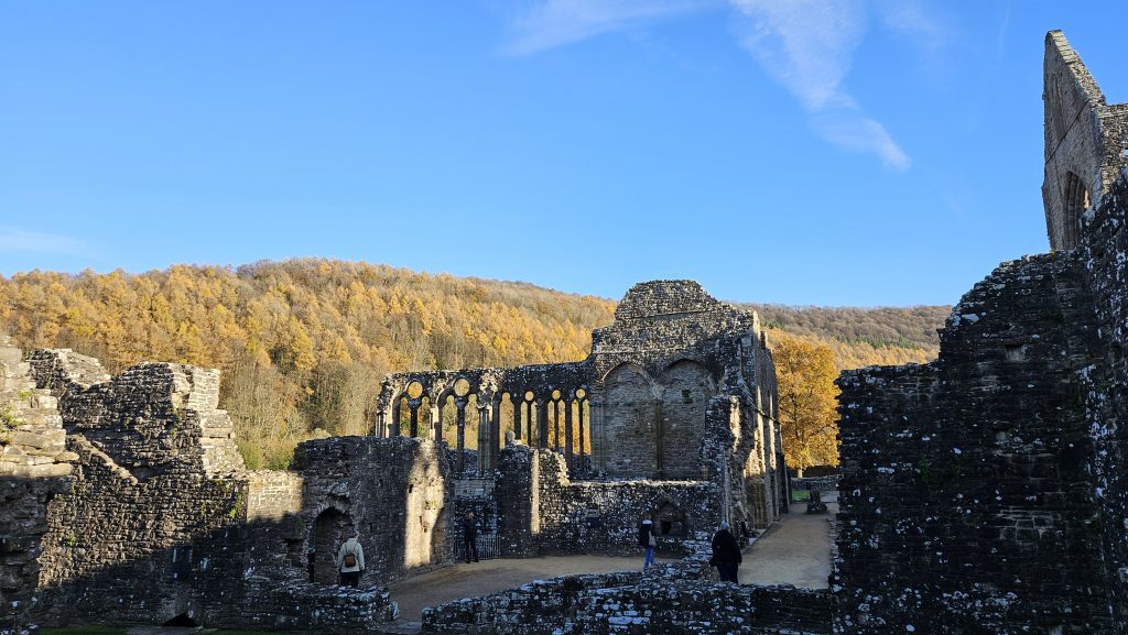
Tintern Abbey to Devil's Pulpit - Circular Walk

Start your walk at Tintern Abbey, and head out on a path that will take you up to the Devil's Pulpit.

The paths can get muddy if it's been raining or during the winter, so wear some good boots.

You'll go up some steep hills and back down, which makes the walk a little challenging.

When you reach Devil's Pulpit, you'll see an amazing view of the Abbey down below. This area is where the poet Wordsworth got inspired to write the famous poem Lines Written a Few Miles above Tintern Abbey.

The walk goes through the woods, and if it's autumn, you'll see lots of beautiful fall colours.

Make sure you're ready for the muddy parts and the steep bits, and you'll have a great time seeing all the sights.

Collection
?
Export
Details
Route Type
Circular
Difficulty
Moderate
Under Foot
Mixed Paths
Car Parking
Ticketed Parking
Key Features
Cultural/Historical Interest<br />Forests & Woodlands<br />National Trail<br />Rivers<br />Roads<br />Wildflowers<br />Wildlife<br />
Points of Interest
  • Tintern Abbey
  • Devil's Pulpit
Refreshments & Facilities

Lots of options in Tintern

More Details

Priors Wood Walk to West Tanpit Wood (Circular)

Details
Priors Wood Walk to West Tanpit Wood (Circular)
sunrise priors wood tyntesfield walk

Prior's Wood Walk Description

There’s something especially pleasing about an early morning walk. The air has a crisp chill and the birds chirp away happily. For a brief spell, you have nature all to yourself. Not a soul in sight.

If you can force yourself awake and get out, this walk from Prior’s Wood to West Tanpit Wood is well worth the effort. So set your alarm and get there early. You’ll be pleased you did.

Whether you’re a natural early bird or not, you’ll really enjoy this walk. Not only does the route include Prior’s Wood and West Tanpit Wood, but also passes through The Sidelands at Tyntesfield and a couple of other little wooded areas along the way. Beautiful.

Prior’s Wood is well known for its bluebell displays which makes this a great circular walk from Prior’s Wood to West Tanpit Wood. With a complete distance of 8.2 miles and a total ascent of 1019ft this walk isn’t too tricky.

We already knew that Prior’s Wood is a great spot for a walk but discovering West Tanpit Wood was a real treat too. Markham Brook runs through the wood with its pleasing sound of running water and a small, picturesque waterfall. Bluebells are sure to be on display here too in a few weeks’ time.

You’ll pass by Lower Failand’s St. Bartholomew’s Church and The Downs school on your way back to Prior’s Wood, each with their own impressive architecture.

Under foot in the winter it will be especially muddy in the woods.

?
Export
Details
Route Type
Circular
Difficulty
Moderate
Under Foot
Mostly Natural
Car Parking
Road Parking
Key Features
Circular Walk<br />Forests & Woodlands<br />National Trust<br />Roads<br />Wildflowers<br />Wildlife<br />
Points of Interest
  • Tyntesfield
  • Prior's Wood
  • West Tanpit Wood
  • Bluebells
  • Noah's Ark Zoo
Refreshments & Facilities
  • Pub in Portbury
More Details

Swineford Circular Walk – Pub Walk to Kelston

Details
Swineford Circular Walk - Pub Walk to Kelston
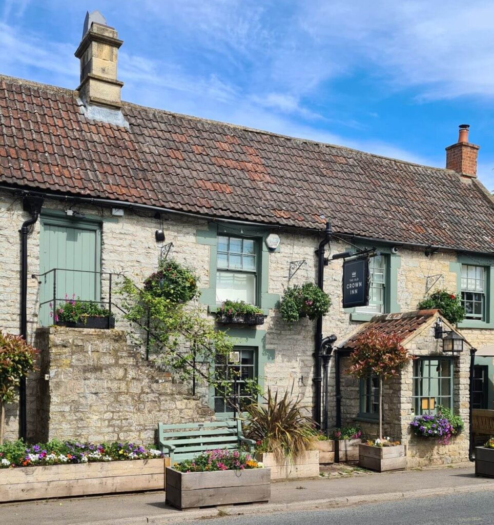
The old crown inn pub, kelston - startpoint of this circular walk to Kelston roundhill

Swineford Circular Walk Description

This is an extended pub walk, similar to the Kelston Roundhill walk.

At over 12 km, it's a nice long walk, but with three excellent pubs to split it up.

?
Export
Details
Route Type
Circular
Difficulty
Moderate
Under Foot
Mixed Paths
Car Parking
Free Parking
Key Features
Circular Walk<br />National Trail<br />Pubs on Route<br />
Summits
  • Kelston Roundhill
Points of Interest
  • Kelston Roundhill
  • The Swan Inn
  • The Upton Inn
  • The Old Crown Inn
Hill Bagging
Trig Points<br />
Refreshments & Facilities
  • The Swan Inn
  • The Upton Inn
  • The Old Crown Inn
More Details