Details
National Trust Walks
?
Export
More Details

Woodchester Park Walk from Coaley Peak

Details
Woodchester Park Walk from Coaley Peak
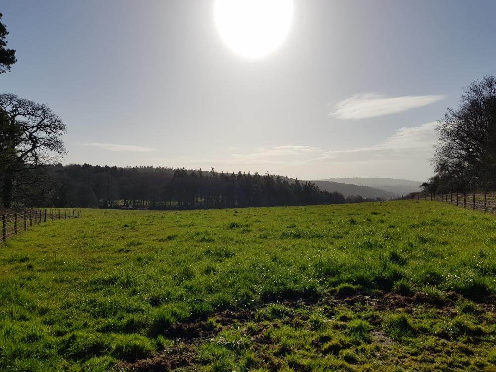
Coaley Peak View

Woodchester Park Walk from Coaley Peak

Enjoy this fairly simple Woodchester Park walk from Coaley Peak. Breathe in the fresh air in the woodland areas and by the ponds, perfect for restoring yourself at the weekend.

Parking at Coaley Peak is perfect if you aren't a National Trust member. And it's also a great way to incorporate the great views from Coaley Peak into your walk around Woodchester Park.

The paths can be incredibly muddy in winter, so make sure you're wearing suitable footwear.

?
Export
Details
Route Type
Circular
Difficulty
Easy
Under Foot
Mostly Natural
Car Parking
Free Parking
Key Features
Circular Walk<br />Forests & Woodlands<br />National Trust<br />Wildflowers<br />Wildlife<br />
Points of Interest
  • Woodchester Park
  • Coaley Peak
  • Nympsfield Longbarrow
More Details

Priors Wood Walk to West Tanpit Wood (Circular)

Details
Priors Wood Walk to West Tanpit Wood (Circular)
sunrise priors wood tyntesfield walk

Prior's Wood Walk Description

There’s something especially pleasing about an early morning walk. The air has a crisp chill and the birds chirp away happily. For a brief spell, you have nature all to yourself. Not a soul in sight.

If you can force yourself awake and get out, this walk from Prior’s Wood to West Tanpit Wood is well worth the effort. So set your alarm and get there early. You’ll be pleased you did.

Whether you’re a natural early bird or not, you’ll really enjoy this walk. Not only does the route include Prior’s Wood and West Tanpit Wood, but also passes through The Sidelands at Tyntesfield and a couple of other little wooded areas along the way. Beautiful.

Prior’s Wood is well known for its bluebell displays which makes this a great circular walk from Prior’s Wood to West Tanpit Wood. With a complete distance of 8.2 miles and a total ascent of 1019ft this walk isn’t too tricky.

We already knew that Prior’s Wood is a great spot for a walk but discovering West Tanpit Wood was a real treat too. Markham Brook runs through the wood with its pleasing sound of running water and a small, picturesque waterfall. Bluebells are sure to be on display here too in a few weeks’ time.

You’ll pass by Lower Failand’s St. Bartholomew’s Church and The Downs school on your way back to Prior’s Wood, each with their own impressive architecture.

Under foot in the winter it will be especially muddy in the woods.

?
Export
Details
Route Type
Circular
Difficulty
Moderate
Under Foot
Mostly Natural
Car Parking
Road Parking
Key Features
Circular Walk<br />Forests & Woodlands<br />National Trust<br />Roads<br />Wildflowers<br />Wildlife<br />
Points of Interest
  • Tyntesfield
  • Prior's Wood
  • West Tanpit Wood
  • Bluebells
  • Noah's Ark Zoo
Refreshments & Facilities
  • Pub in Portbury
More Details

Mam Tor to Lose Hill Circular Walk

Details
Mam Tor to Lose Hill Circular Walk
Mam Tor Trig Point & Summit

Mam Tor to Lose Hill Circular Walk — Description

This circular Mam Tor to Lose Hill walk along The Great Ridge is one many people take. This circular route provides amazing views every step of the way and includes the stunning Cave Dale too, which is often forgotten or overlooked.

This walk starts in Castleton where there is a couple of car parks and plenty of pubs or cafes for refreshments.

Almost immediately, you are immersed in stunning scenery. A tough stomp through Cave Dale is a great way to start the walk, and it’s not long before you have enough elevation to enjoy great views of the Peak District landscape.

The climb up Mam Tor is not so tough, and the path is paved very well underfoot. At the summit, suddenly it seems there’s an influx of people, with others arriving from different routes. Sheep perch themselves on the cliff edge, out of the way of the human intruders.

The walk along The Great Ridge from Mam Tor to Lose Hill is hugely enjoyable. Fantastic views to be had in all directions and the impressive Back Tor is not to be missed. Yellow gorse flowers cling to the side of its steep cliff edge. A great spot to stop for a sandwich and a snack.

From Lose Hill, you descend to Hope with one last impressive view back to Mam Tor.

From Hope, it's a pleasant stroll back to Castleton through fields and alongside Peakshole Water.

Alternative Routes up Mam Tor & Lose Hill

There are lots of different routes you can take to walk up Mam Tor and Lose Hill. You can follow this route, but descend at Hollins Cross, rather than Lose Hill. Or cut back from Lose Hill directly to Castleton. You could even skip Cave Dale, but it’s well worth the extra effort.

?
Export
Details
Route Type
Circular
Difficulty
Hard
Under Foot
Mostly Natural
Car Parking
Free Parking
Key Features
Caves<br />Circular Walk<br />Mountains<br />National Trail<br />Pubs on Route<br />Roads<br />Summit Route<br />Wildflowers<br />Wildlife<br />
Summits
  • Mam Tor — 524 m
  • Hollins Cross — 390 m
  • Barker Bank — 425 m
  • Back Tor — 438 m
  • Lose Hill — 481 m
Points of Interest
  • Peveril Castle
  • Cave Dale
  • Hope Valley
Hill Bagging
Trig Points<br />
Refreshments & Facilities

Lots of options in Castleton or Hope

More Details

Cadbury Camp Walk

Details
Cadbury Camp Walk
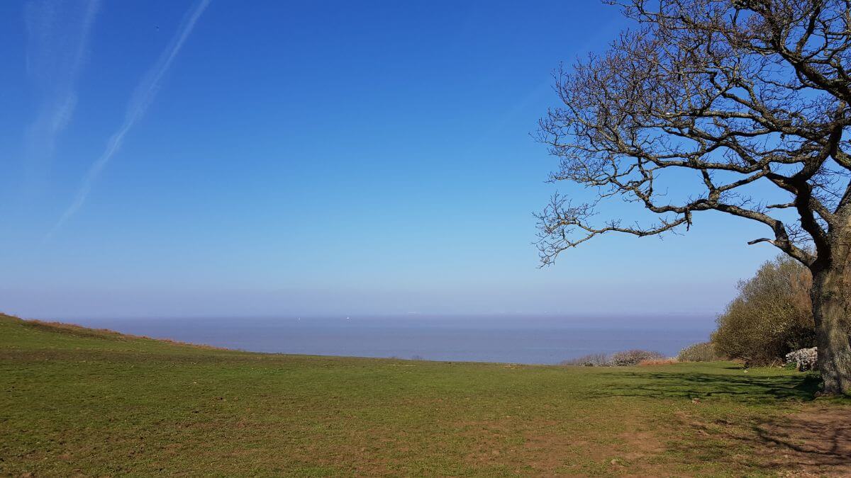
view to the sea from near clevedon golf club

Cadbury Camp Circular Walk — Description

Cadbury Camp is an Iron Age hillfort above the village of Tickenham, near Portishead, Clevedon and Nailsea. You can do a short and simple walk from Tickenham if you prefer, but this is a long and challenging walk.

This circular Cadbury Camp walk has a bit of everything: quaint waterways at Moorend Spout followed by a steep climb up Cadbury Camp and a coastal walk towards Redcliff Bay.

The hidden gem of Moorend Spout is not far from your start point. It's a valuable wildlife habitat and a nature reserve. There’s a constantly flowing waterfall which you can follow a bridged path over.

Once you do move on, it’s not far until you hit your first real climb of the day: Cadbury Camp. There’s several routes up Cadbury Camp, but this route takes you right up the steepest path. Thankfully, once you get to the top you can enjoy some fantastic views. It’s a great spot for a quick sit down and a coffee.

From Cadbury Camp, you'll head southwest along a wooded track before heading over the M5 on a footbridge. There’s something a little disconcerting about watching all of those cars, trucks and lorries speeding along underneath you.

Once you’ve crossed the bridge it’s a fairly straight line walk to Walton in Gordano. From there, pass the church and head up the footpath towards Clevedon Golf Club. Beware, you will need to cross a fairway, so keep your eyes and ears open.

Once past the golf course, the coastal path is narrow with little in the way of stopping you tumbling down to the rocks below. It can be a little difficult to navigate your way past others coming the other way, so watch your footing and tread carefully.

Black Nore Lighthouse makes a great spot for some lunch, and if you’re lucky you’ll be able to watch some ships passing by. From the lighthouse, it’s an uphill struggle again up through the streets of Redcliffe Bay, across Merlin Park and up through Weston Big Wood.

Out the other side, cross straight across The Rhyne heading towards Clapton in Gordano. There’s a lovely little pub here called the Black Horse Inn where you can stop for a pint.

A couple more woodland paths through Mogg’s Wood and Towerhouse Wood to enjoy, and then back across Land Yeo River towards Nailsea.

A very long but rewarding circular walk up incorporating Cadbury Camp and much more.

?
Export
Details
Route Type
Circular
Difficulty
Hard
Under Foot
Mostly Good Paths
Car Parking
Road Parking
Points of Interest
  • Cadbury Camp — Iron Age Hillfort.
  • Moorend Nature Reserve — A valuable wildlife habitat.
  • Churches — Church of SS Quiricus & Julietta, St. Paul's Church and St. Michael's Church
  • Bays — Margaret's Bay, Pidgeon House Bay, Walton Bay, Charlcombe Bay, Redcliff Bay
  • Black Nore Lighthouse — Grade II listed building.
Refreshments & Facilities
  • The Black Horse Inn, Clapton-in-Gordano
  • Many places in Portishead
More Details

Sand Point & Middle Hope Circular Walk

Details
Sand Point & Middle Hope Circular Walk
sand point view

Sand Point & Middle Hope Circular Walk — Description

Sand Point and Middle Hope is a lovely stretch of coastline managed by the National Trust with beautiful views across to Wales and out to sea.

The walk around Sand Point and Middle Hope itself is around five miles and pleasant enough. But this walk extends it up through Weston Woods and back around through Kewstoke. This increases your walk to around ten miles and gives you a bit more to explore including a sandy beach and an iron age hillfort at the heart of Weston Woods.

The woods lead out into Kewstoke, a lovely little village with a couple of different options for refreshments if you need to stop before heading back towards the car park by way of the inland roads and bridleways.

Start from the National Trust’s Priory Car Park near Woodspring Priory where you can take a footpath up the steps and through a metal gate. This section isn’t very well signposted, but when you reach a small lake, take a left into the field and from here you can take various paths. Your best bet is to head through the fields towards the coast and follow it all the way to Sand Point.

Middle Hope is an incredible stretch of coast with interesting coves to explore if you don’t mind clambering over a few rocks to join the fisherman on the shore. If you prefer steadier ground, the fields along the coast are very pleasant, packed with sheep and their little lambs baaing away.

Upon reaching Sand Point you can enjoy stunning views out to sea and across to Wales before heading back on the southern side towards Sand Bay. There is lots of interesting flora to enjoy on this rocky peninsula such as honewort and smallflower buttercups as well as oxeye daisies and speedwell flowers in bloom.

Sand Bay really lives up to its name. While Middle Hope was all about rocky coves and interesting rock formations, Sand Bay presented a golden beach to stroll along. There were plenty dog walkers and families enjoying the sunshine as we stopped for a coffee and some homemade shortbread on the sandy beach.

The path through the woods follows the road quite closely, before you eventually reach the furthest point where you can turn back on yourself and head up to Worlebury Camp hillfort.

The hillfort dates back to around 600BC and is stone built which is apparently quite rare for hillforts in England. The fort was well defended with numerous walls, embankments and ditches around the site. Despite the defences, excavators found remains of skeletons with violent damage suggesting their deaths were a result of a vicious attack on the hillfort.

Once you’ve learned about the hillfort you can head back towards Kewstoke, stop for some refreshments or follow the roads and bridleways back to the Priory Car Park start point. The bridleways offer yet another contrasting experience on this walk. From the rocky coast of Middle Hope to the sandy beach of Sand Bay and the woodland path in Weston Woods, you can now enjoy a pleasant inland stroll through grassy fields flanked by the rhyne.

The terrain on this walk is very mixed. Under foot you will need to be prepared for fields, beaches, and woodland paths which could be muddy in bad weather. From Kewstoke, there is a little bit of road walking before you return back to the National Trust car park.

?
Export
Details
Route Type
Circular
Difficulty
Easy
Under Foot
Mixed Paths
Car Parking
Free Parking
Key Features
Points of Interest
  • Sand Point — National Trust maintained and wildlife friendly natural pier.
  • Middle Hope — Wildlife friendly scrubland.
  • Worlebury Camp — Historic hillfort.
  • Sand Bay — Sandy beach.
  • Woodspring Priory — Former priory converted into a farmhouse and owned by the Landmark Trust.
Refreshments & Facilities
  • Food and drink refreshments available in Kewstoke
More Details

Gowbarrow Fell Circular Walk

Details
Gowbarrow Fell Circular Walk
Ullswater from Gowbarrow Fell

Gowbarrow Fell Circular Walk — Description

Gowbarrow Fell is one of the 214 Wainwright fells in the Lake District. To count as a Wainwright, the fell must be included in Alfred Wainwright's monumental seven-volume Pictorial Guide to the Lakeland Fells. This route to Gowbarrow Fell is from Aira Force, and is one of the most popular ways to visit the fell.

Alfred Wainwright on Gowbarrow Fell

In his guide to the Lakeland Fells, Alfred Wainwright describes Aira Force as Gowbarrow Fell’s great attraction:

"Gowbarrow Fell is one of the best known of Lakeland’s lesser heights, much of it being National Trust property and a favourite playground and picnic place. It is not the fell itself that brings the crowds, however, and its summit is lonely enough: the great attraction is Aira Force, on the beck forming its western boundary."

"It is not the fell itself that brings the crowds, [...] the great attraction is Aira Force."
— Alfred Wainwright

It's true that the great attraction of this walk is the Aira Force waterfalls. In fact, many people will come just for the falls, and not Gowbarrow Fell itself. That being said, this is a stunning little walk. And all the better when you get away from the crowds at Aira Force.

You start the walk by skirting alongside Ullswater with fantastic views over the lake. The ascent is steady to begin with, as you make your way up to a viewing point, where you can take in almost the entirety of the 7-mile long Ullswater Lake.

From here, the walk starts to be a little more strenuous as you head up to the summit of Gowbarrow Fell.

There is a National Trust trig-point on the summit, which Alfred Wainwright also describes as "drab". I think that’s a slightly harsh description, but the best of the views are on the route up, rather than on the summit itself.

From the summit, you can take various paths back down towards Aira Force waterfalls and your finish point.

Under foot, expect muddy and boggy areas but mostly the paths are in good condition.

Little Mell Fell and Great Mell Fell are also close by and you could loop them together.

?
Export
Details
Route Type
Circular
Difficulty
Moderate
Under Foot
Mixed Paths
Car Parking
Ticketed Parking
Summits
  • Gowbarrow Fell — 481 m
Points of Interest
  • Aira Force Waterfalls — Powerful 65-foot waterfall.
  • Memorial Seat Viewing Point — A great spot for stunning views across Ullswater.
  • Wainwright Fell Summit — Gowbarrow Fell.
  • Gowbarrow Park — Lots of walking routes up to Gowbarrow Fell.
  • Ullswater Way — A 20 mile walking route around the whole of Ullswater lake.
Hill Bagging
Trig Points<br />Wainwrights<br />Birketts<br />
Refreshments & Facilities

None

More Details

The Kymin Circular Walk

Details
The Kymin Circular Walk
the kymin, national trust property

The Kymin Circular Walk Description

This is a pleasant and mostly straightforward circular walk from The Kymin, near Monmouth. The Kymin itself is a charming 18th-century round house that is now maintained by the National Trust.

The walk starts from the free National Trust car park at The Kymin and descends through woodland paths until you reach the River Wye. The route then follows the river all the way to the Wye Bridge in Monmouth, before joining Offa's Dyke Path for a steep climb back to The Kymin.

Under foot, you can expect mostly good paths on this Kymin walk. However, during winter and after heavy rain, you should expect some muddy areas in the woods.

At 8.6 miles long, this walk is moderately challenging with the steep ascent coming right at the end of the walk.

?
Export
Details
Route Type
Circular
Difficulty
Moderate
Under Foot
Mostly Good Paths
Car Parking
Free Parking
Key Features
Summits
  • Kymin — 840 ft
Points of Interest
  • The Kymin Round House — A small and charming castellated banqueting house built for entertaining in the 18th century. Now maintained by the National Trust.
  • The Kymin Naval Temple — The Naval Temple was built in the early 1800s and celebrates the life of British Admirals from the time.
  • Staunton Suck Stone — Known to be the largest detached block of rock in the UK.
  • Everard Oak — A memorial to John Everard, now somewhat hidden by birch trees.
  • Biblins Bridge — A wobbly rope bridge across the River Wye.
  • Little Doward Limekiln — Dating from the 1700s.
  • St Peter's Church, Dixton — A quaint little chuch on the outskirts of Monmouth with a glorious dogwood tree in the graveyard.
  • The Wye Bridge — A historic bridge dating from the medieval period.
Refreshments & Facilities
  • Their is plenty of options for refreshments within Monmouth.
  • National Trust facilities at The Kymin are only available if the Round House is open for visitors.
More Details