Details
All Walks
?
Export
More Details

Mynydd Llangorse Walk

Details
Mynydd Llangorse Walk
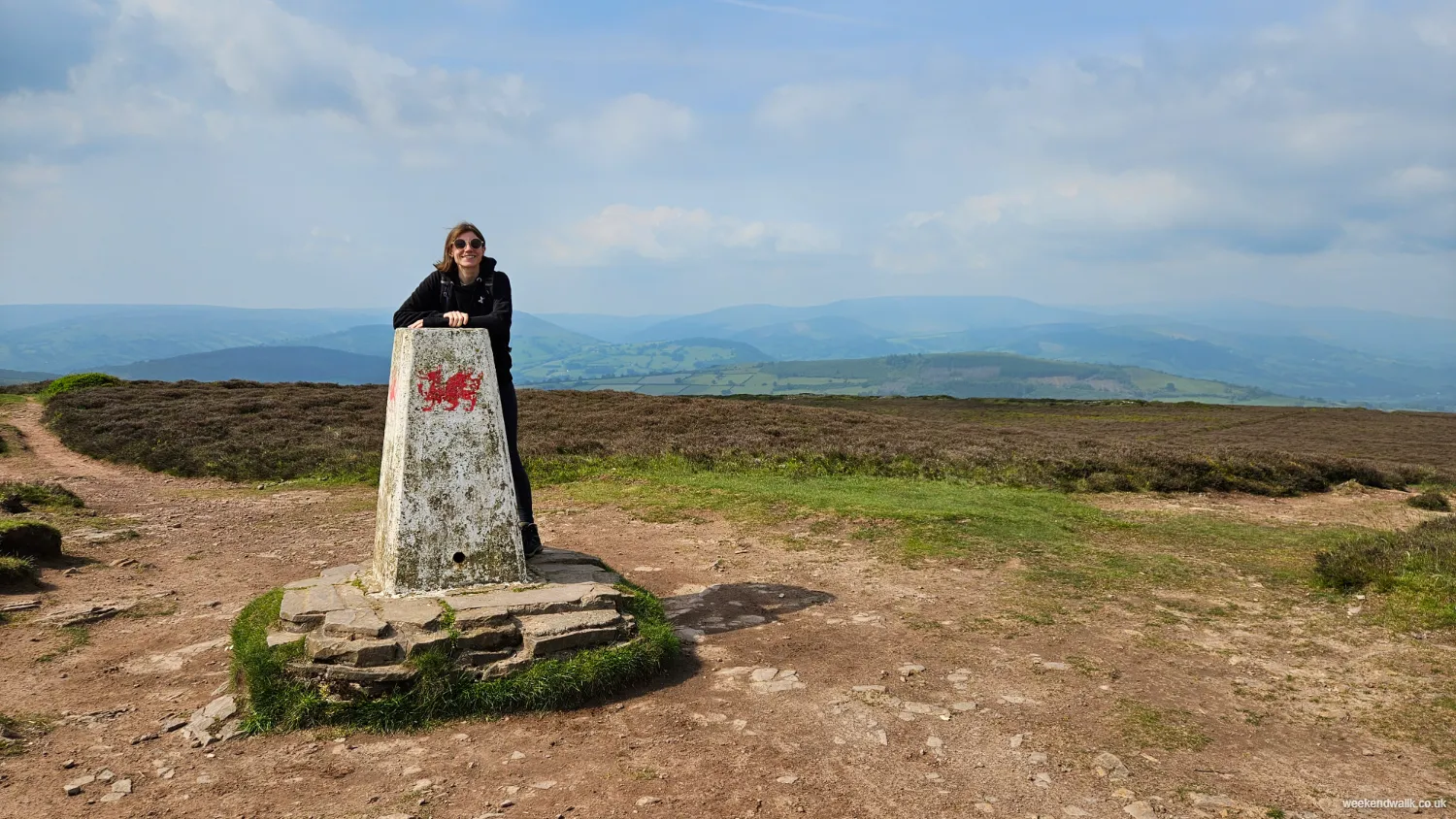
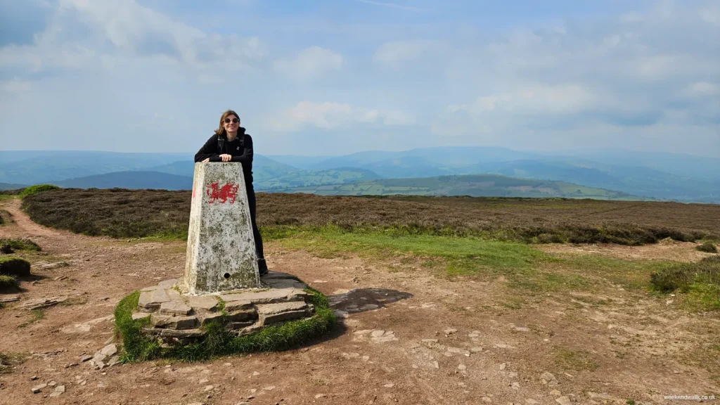
trig point on mynydd llangorse walk

Mynydd Llangorse Walking Route

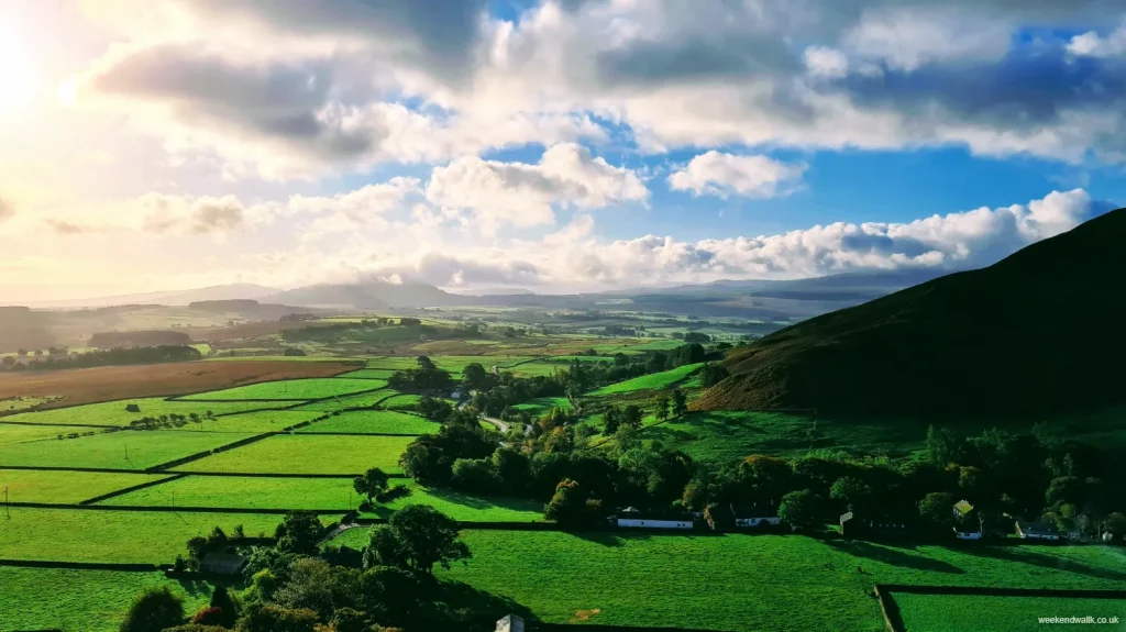
Starting from the village of Llangorse, you’ll notice the landscape gradually changing as you proceed on this walk—gentle fields give way to more undulating terrain, with the Brecon Beacons subtly rising in the distance.

The path begins quite easily, leading you along quiet country lanes that are bordered by hedgerows. You might catch the occasional glimpse of Llangorse Lake, glinting in the sunlight. As you continue, the route becomes more challenging, with the track narrowing and beginning its steady ascent. This is where the real hike begins.

As you climb higher, the terrain starts to open up, offering wider views of the surrounding landscape. You'll notice the patchwork of fields below, the neat lines of stone walls, and the distant outline of Pen y Fan, the highest peak in southern Britain.

The path can be a bit rocky and uneven in places, so it’s a good idea to watch your step, especially if the ground is wet. But every now and then, take a moment to look back—the views just keep getting better.

Eventually, you’ll reach the summit of Mynydd Llangorse, marked by a trig point. Standing here, you’ll feel like you’re on top of the world. The panoramic views are stunning: to the north, you can see the Black Mountains; to the west, the peaks of the central Brecon Beacons; and to the south, the Usk Valley stretches out towards the horizon.

The walk down is much easier, and as you return to the village, you'll probably find yourself already thinking about when you can come back to explore more of this beautiful part of Wales.

?
Export
Details
Route Type
Circular
Difficulty
Moderate
Under Foot
Mostly Good Paths
Car Parking
Free Parking
Key Features
Circular Walk<br />Lakes<br />Mountains<br />Roads<br />Summit Route<br />Wildflowers<br />Wildlife<br />
Summits
  • Mynydd Llangorse
Hill Bagging
Trig Points<br />
Refreshments & Facilities

Llangorse Village

More Details

Pen y Gadair Fawr Walk via Mynydd du Forest

Details
Pen y Gadair Fawr Walk via Mynydd du Forest
mynydd du forest on pen y gadair fawr walk

Pen y Gadair Fawr Walking Route

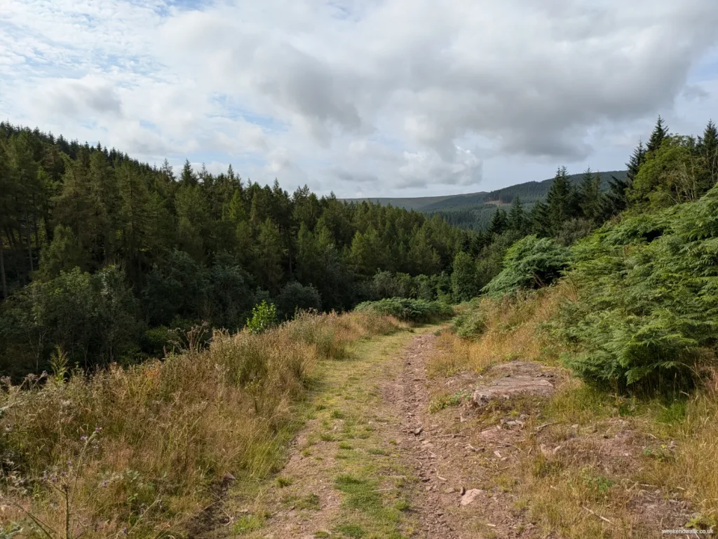
Starting at the Pont Cadwgan car park, you’ll find a well-marked path heading up through the forest on the left hand side of the car park.

The walk kicks off by heading along a path through Mynydd Du forest before heading up Pen y Gadair Fawr, a peak that reaches 800 meters. The ascent is steady but manageable, and you’ll find plenty of spots to stop and catch your breath while soaking in the views, including a lovely spot by a stream.

When you reach the summit of Pen y Gadair Fawr, the panoramic views are fantastic. You can see for miles around, taking in the beauty of the Brecon Beacons and beyond. It’s a great place to pause, take some photos, and enjoy the fresh mountain air.

From Pen y Gadair Fawr, you’ll continue your hike by heading towards Pen Twyn Mawr and Pen Gwyllt Meirch. The route here can be a bit rugged, so watch your footing.

The descent takes you through Mynydd Du Forest. The forest paths are a nice change of pace and provide a cool, shaded walk back to the car park.

?
Export
Details
Route Type
Circular
Difficulty
Moderate
Under Foot
Mixed Paths
Car Parking
Free Parking
Key Features
Circular Walk<br />Forests & Woodlands<br />Mountains<br />Rivers<br />Summit Route<br />Wildflowers<br />Wildlife<br />
Summits
  • Pen y Gadair Fawr
Refreshments & Facilities

None

More Details

Fan Fawr & Fan Frynych Walk

Details
Fan Fawr & Fan Frynych Walk
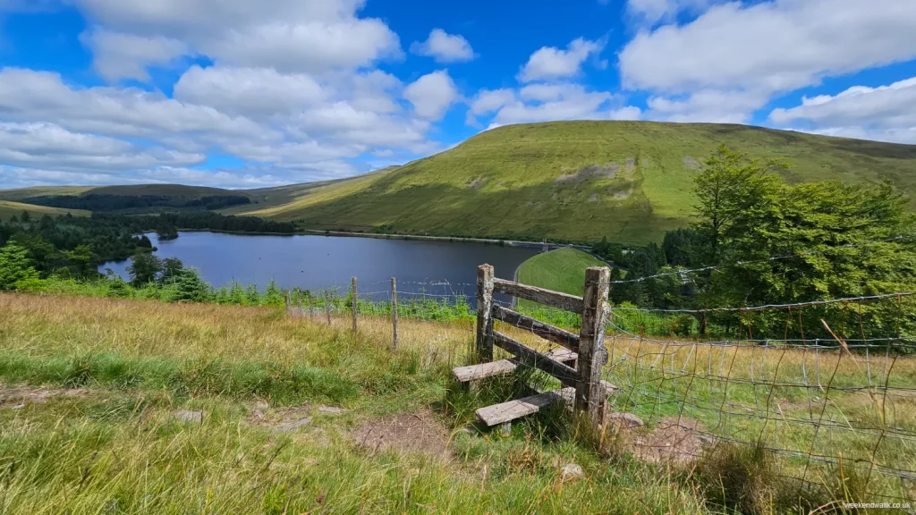
stile and countryside on fan fawr & fan frynych walk

Fan Fawr & Fan Frynych Circular Walk

If you're up for a challenging hike, the walk up Fan Frynych and Fan Fawr in the Brecon Beacons is much tougher than walking up Pen-y-Fan from the same starting point.

You first tackle Fan Frynych, which stands at 629 meters. The climb is steep and can be tough, but the views of Pen-y-Fan and the surrounding hills are absolutely worth it.

Once you've caught your breath and soaked in the scenery, you push on to Fan Fawr. This peak is even higher, reaching 734 meters, and the ascent is no joke. It's a tough climb with rugged terrain, but once you reach the top, the panoramic views are simply breathtaking.

This hike is definitely demanding, but for those who love a challenge and spectacular views, it’s an unforgettable experience.

Personally, I wouldn't head up Fan Fawr on this route in bad weather as the paths are steep and slippery.

?
Export
Details
Route Type
Circular
Difficulty
Hard
Under Foot
Mostly Natural
Car Parking
Ticketed Parking
Key Features
Circular Walk<br />Mountains<br />Roads<br />Summit Route<br />Wildflowers<br />
Summits
  • Fan Fawr
  • Fan Frynych
  • Craig Cerrig-gleisiad
Hill Bagging
Trig Points<br />Nuttals<br />
More Details

Pen-y-Fan & Cribyn Circular Walk

Details
Pen-y-Fan & Cribyn Circular Walk
Ascent up Pen y Fan

Pen y Fan & Cribyn Circular Walk from Cwn Gwdi Car Park

If you're looking for an epic hike in the Brecon Beacons, this Pen y Fan and Cribyn circular walk from Cwm Gwdi Car Park is a must-do.

You start at the Cwm Gwdi car park, where you can take a deep breath of fresh mountain air and prepare for an adventure. The trail begins with a steady climb, winding its way up through beautiful, rolling landscapes. As you ascend, the views start to open up, giving you a sneak peek of the incredible scenery to come.

Your first big challenge is Pen y Fan, the highest peak in South Wales at 886 meters. It's a tough climb, but when you reach the summit, the 360-degree views are absolutely worth it. On a clear day, you can see for miles!

After soaking in the stunning vistas from Pen y Fan, you head down and then up again to Cribyn, which stands at 795 meters. The ascent to Cribyn is steep and can be challenging, but it's a rewarding climb with equally impressive views.

Once you've taken in the sights from Cribyn, the path gradually descends, looping back towards Cwm Gwdi. The circular route allows you to enjoy different perspectives and scenery on the way back down.

Overall, this hike is a fantastic mix of challenging climbs and breathtaking landscapes, perfect for anyone who loves being out in nature and is up for a bit of a challenge. It's a great way to spend a day in the mountains, with plenty of opportunities to take photos and create lasting memories.

?
Export
Details
Route Type
Circular
Difficulty
Moderate
Under Foot
Good Paths
Car Parking
Free Parking
Key Features
Circular Walk<br />Mountains<br />National Trust<br />Summit Route<br />Wildflowers<br />Wildlife<br />
Summits
  • Pen y Fan
  • Cribyn
Hill Bagging
Nuttals<br />
More Info

For an alternative and perhaps even tougher walk, try this alternative route: Pen y Fan, Cribyn, Fan y Big & Bwich-Y-Ddwyallt walk.

More Details

Mither Tap Walk from Bennachie Visitor Centre

Details
Mither Tap Walk from Bennachie Visitor Centre
Mither Tap

Mither Tap Walk

Starting at the Bennachie Visitor Centre, you'll find plenty of parking and useful information about the trails.

From the Visitor Centre, head out on the well-marked path towards Mither Tap. The trail starts off gently, winding through beautiful woodlands where you can enjoy the sounds of birds and the rustle of leaves. It's a peaceful beginning, perfect for warming up your legs.

As you continue, the path starts to climb more steeply, and the trees thin out, giving you glimpses of the stunning views ahead. Keep following the signs for Mither Tap, and before long, you'll be out in the open with the distinctive granite tor of Mither Tap coming into clear view.

The final ascent to the summit is a bit of a scramble over rocky terrain, but it's nothing too tricky if you take your time. Once you reach the top, at 518 meters, the panoramic views are incredible. You can see for miles over the Aberdeenshire countryside, and it's a perfect spot to take a break, have a snack, and snap some photos.

After soaking in the views and enjoying the summit, you simply head back down the way you came. The descent gives you another chance to enjoy the beautiful scenery and maybe spot some wildlife you missed on the way up.

Back at the Bennachie Visitor Centre, you can relax and check out any exhibits or grab a refreshment. This walk is a wonderful mix of woodland paths, open moorland, and a rewarding climb, making it a perfect day out for anyone who loves nature and a good hike.

Collection
?
Export
Details
Route Type
Linear
Difficulty
Easy
Under Foot
Mixed Paths
Car Parking
Free Parking
Key Features
Cultural/Historical Interest<br />Forests & Woodlands<br />Linear Walk<br />Summit Route<br />Wildflowers<br />Wildlife<br />
Summits
  • Mither Tap
Refreshments & Facilities
  • Bennachie Visitor Centre
More Details

Souther Fell Walk

Details
Souther Fell Walk
View of Blencathra from Souther Fell

Souther Fell

Souther Fell is nestled in the picturesque northern Lake District. One of Wainwright's 214 fells, Souther Fell stands at 522 m, making it a fairly easy climb for the experienced hiker. But Souther Fell's best quality is its views. It boasts stunning views of Blencathra, one of the most imposing Northern Fells as well as Bannerdale Crags, Bowscale Fell and more.

Souther Fell Walking Route

We started our journey in the charming village of Mungrisdale, on a crisp morning. The path began gently, winding through the beautiful northern Lake District scenery. As we walked, the views of the countryside and the quaint village below started to open up, making the gradual ascent enjoyable.

The climb was moderate, nothing too strenuous, and we took our time to soak in the peaceful surroundings.

At the summit of Souther Fell is some stunning panoramic views of Blencathra standing majestically nearby. It felt great to sit down for a moment, take a deep breath, and appreciate the accomplishment of bagging another Wainwright.

If you're after something a little more strenuous you could try our other route incorporating Souther Fell, Blencathra, Bowscale Fell & Bannerdale Crags. Alternatively, our walk around Bowscale Fell & Bannerdale Crags.

?
Export
Details
Route Type
Circular
Difficulty
Moderate
Under Foot
Mostly Natural
Car Parking
Free Parking
Key Features
Circular Walk<br />Mountains<br />Rivers<br />Summit Route<br />Wainwright Fells<br />Wildflowers<br />Wildlife<br />
Summits
  • Souther Fell
Hill Bagging
Wainwrights<br />
Refreshments & Facilities

None

More Info

Wainwright on Souther Fell

In his Pictorial Guide to the Lakeland Fells, Alfred Wainwright describes Souther Fell as occupying "an important position as a cornerstone of the Northern Fells", and yet still describes it as having "little merit".

On ascending Souther Fell from Mungrisdale, Wainwright says "the downward view of Mungrisdale during the first part of the climb is delightful".

The Spectral Army of Soutra Fell

Wainwright also devotes a couple of paragraphs to the legend of the The Spectral Army of Soutra Fell in his guide. Wainwright writes that "this is no legend. This is the solemn truth", whereby a "spectral army" appeared marching along the crest of Souther Fell on Midsummer's Day, 1745. Soutra Fell is how Souther Fell was likely referred to in 1745 when this happened.

The spectral army was an unbroken line of quickly moving troops extending over the full length of Souther Fell. However, when the fell was explored the following day, no sign of the army could be seen and Wainwright suggests the only explanation ever given was that of a mirage.

So when you're walking up Souther Fell, beware the spectral army!

More Details

Bowscale Fell & Bannerdale Crags Walk

Details
Bowscale Fell & Bannerdale Crags Walk
farmland from Bowscale Fell

Bowscale Fell & Bannerdale Crags - Wainwright Walk

Starting off in Mungrisdale, we set out on a beautiful morning, eager to explore the fells and tick off two Wainwrights - Bowscale Fell and Bannerdale Crags. The village was quaint and charming, a perfect starting point for a day in the hills.

The ascent up Bowscale Fell was steady but manageable, and we took our time, enjoying the tranquillity and the increasingly expansive views.

As we reached the summit, the panorama that unfolded was absolutely stunning. It was a peaceful spot, perfect for a short rest and a chance to soak in the scenery.

From Bowscale Fell, we headed towards Bannerdale Crags. The path dipped and rose gently, fairly easy going after the initial start. You can alternatively take the route on The Tongue at this point too.

The transition from Bowscale to Bannerdale was seamless, and before long, we were standing on the crags, looking out over the beautiful landscape.

After spending some time exploring Bannerdale Crags, we started the descent back towards Mungrisdale. The path was clear and well-trodden, making for a pleasant walk down.

This Bowscale Fell & Bannerdale Crags walk was a perfect blend of manageable climbs and stunning views. It was a great way to experience the beauty of the Lake District without venturing too far off the beaten path.

If you're looking for something a little more strenuous and want to tick off even more Wainwrights, take a look at our Blencathra route via Bowscale Fell and Bannerdale Crags, which also incorporates Souther Fell.

Alternatively, for an easier stroll nearby, try our quick route up and down Souther Fell.

?
Export
Details
Route Type
Circular
Difficulty
Moderate
Under Foot
Mixed Paths
Car Parking
Free Parking
Key Features
Circular Walk<br />Mountains<br />Rivers<br />Summit Route<br />Wainwright Fells<br />Wildflowers<br />Wildlife<br />
Summits
  • Bowscale Fell
  • Bannerdale Crags
Hill Bagging
Wainwrights<br />Birketts<br />Nuttals<br />Hewitts<br />
Refreshments & Facilities
  • None
More Info

Wainwright on Bannerdale Crags & Bowscale Fell

"Bowscale Fell and its near neighbour, Bannerdale Crags, are usually visited during the same walk, and it is especially interesting to note how the distant view southwest changes in the shortt mile between the two summits, due to the impending mass of Blencathra. From Bowscale Fell the distant skyline appears to the right of Blencathra and features the Buttermere fells; from Bannerdale Crags the view is seen to the left of Blencathra and is of the Langdale and Coniston Fells."
— Alfred Wainwright

More Details

Walking up Blencathra via Sharp Edge

Details
Walking up Blencathra via Sharp Edge
Sharp Edge, Blencathra

Blencathra via Sharp Edge Walking Route

Only attempt this walk if you are confident you can ascend Sharp Edge. Only ascend Sharp Edge in good weather and do more research on the route before you go, such as via the Visit Lake District website.

Starting from the car park in Scales, located at the foot of Blencathra in the Lake District, begin by following the clearly marked path that leads towards Scales Fell. As you ascend, you'll be treated to picturesque views of the surrounding countryside.

Continue along the path until you reach Scales Tarn, a beautiful mountain lake nestled below Blencathra.

Sharp Edge

From Scales Tarn, the real challenge begins as you approach the base of Sharp Edge. This iconic ridge is known for its exposed scrambling sections and requires careful navigation and surefootedness. Ascend gradually, taking your time to negotiate the rocky outcrops and narrow ledges.

As you make your way along Sharp Edge, you'll be rewarded with breathtaking views of the surrounding fells and valleys. Keep your wits about you as you traverse the ridge, enjoying the sense of exhilaration that comes with each step.

After conquering Sharp Edge, the remainder of the ascent to the summit of Blencathra is relatively straightforward. Follow the well-defined path as it winds its way up the final slopes, taking in the sweeping vistas that unfold before you.

Upon reaching the summit of Blencathra, take a moment to celebrate your achievement and soak in the panoramic views of the Lake District. From here, you can see for miles in every direction, with towering peaks and rolling hills stretching out to the horizon.

After enjoying a well-deserved rest at the summit, begin your gradual descent and enjoy the different perspectives of the mountain and its surroundings.

Blencathra via Sharp Edge is not just a hike—it's an experience that will stay with you long after you've conquered it.

For an alternative route that doesn't involve Sharp Edge, view our longer Blencathra hike incorporating Souther Fell, Bowscale Fell, Mungrisdale Common and Bannerdale Crags.

?
Export
Details
Route Type
Circular
Difficulty
Hard
Under Foot
Mixed Paths
Car Parking
Free Parking
Key Features
Circular Walk<br />Mountains<br />Summit Route<br />Wainwright Fells<br />Wildflowers<br />Wildlife<br />
Summits
  • Blencathra
Hill Bagging
Wainwrights<br />Marilyns<br />Birketts<br />Nuttals<br />Hewitts<br />Trail 100<br />
Refreshments & Facilities

None

More Info

Wainwright on Blencathra & Sharp Edge

In his Pictorial Guide to the Lakeland Fells, Alfred Wainwright devotes a full 36 pages to Blencathra, underscoring its place as one of the most imposing fells in the Lake District.

Wainwright describes Blencathra as:

"one of the grandest objects in Lakeland. And of the best known. Seen from the south-west [Blencathra] rises steeply and in isolation above the broad green fields of Threlkeld. [...] This is a mountain that compels attention [...]. To artists and photographers it is an obvious subject for their craft; to sightseers passing along the road or railway at its base, its influence is magnetic; to the dalesfolk it is the eternal background to their lives, there at birth, there at death. But most of all, it is a mountaineers' mountain.

The supreme feature of Blencathra, the one that invests the mountain with special grandeur, is the imposing southern front, a remarkable example of the effect of elemental natural forces. It forms a tremendous facade above the valley, and makes a dark, towering backcloth to a stage of farmsteads and cottages, of emerald pastures and meadows and woodlands along its base."
— Alfred Wainwright

If you wish to walk up Blencathra via Sharp Edge, Wainwright offers vivid insight in his typical charismatic style:

"The route has a long established reputation and is deservedly popular. Sharp Edge is a rising crest of naked rock, of sensational and spectacular appearance of breaking wave carved in stone. The sight of it at close quarters is sufficient to make a beholder about to tackle it forget all other worries, even a raging toothache. The crest itself is sharp enough for shaving (the former name was Razor Edge) and can be traversed only à chevalat some risk of damage to tender parts."
— Alfred Wainwright

More Details

Blencathra, Mungrisdale, Bannerdale, Bowscale & Souther Fell Walk

Details
Blencathra, Mungrisdale, Bannerdale, Bowscale & Souther Fell Walk
View of Blencathra from Souther Fell

The Blencathra Group — Blencathra, Mungrisdale, Bannerdale, Bowscale & Souther Fell

From the wild beauty of Bowscale Fell to the rugged grandeur of Blencathra, this route has it all. So next time you find yourself in the Lake District, why not give it a go? Trust me, you won't be disappointed.

Bowscale

Starting from Mungrisdale, this walk starts with a steady incline up Bowscale Fell which gets the blood pumping. The path winds its way through heather-clad slopes, offering glimpses of the surrounding valleys below. It's a peaceful start to the walk, with nothing but the sound of birdsong and the rustle of the wind through the grass.

As we reach the summit of Bowscale Fell, the views open up in all directions. It's a breathtaking panorama that makes the climb worth every step.

Bannerdale Crags

Next up, we make our way over to Bannerdale Crags, following the ridge line as it dips and rises. The terrain here is a bit more rugged, but wonderful views in all directions.

Mungrisdale Common

From Bannerdale Crags, we head over to Mungrisdale Common, crossing rolling moorland dotted with sheep and wildflowers. The path is easy going, and we take our time soaking in the serenity of the landscape.

Blencathra

Now, the highlight of the walk—Blencathra. This iconic peak looms large on the horizon, beckoning us closer with its sheer cliffs and craggy ridges. The final ascent is a bit of a challenge, but the sense of achievement when we reach the summit is unbeatable. And the views? Absolutely spectacular. For an even more challenging ascent of Blencathra, view our Blencathra via Sharp Edge route.

Souther Fell

Finally, we make our way down from Blencathra and onto Souther Fell, our last stop on this epic journey. The descent is gentle, with lush green slopes leading us back towards the valley below.

?
Export
Details
Route Type
Circular
Difficulty
Hard
Under Foot
Mixed Paths
Car Parking
Free Parking
Key Features
Circular Walk<br />Mountains<br />Summit Route<br />Wainwright Fells<br />Wildflowers<br />Wildlife<br />
Summits
  • Bowscale Fell
  • Bannerdale Crags
  • Mungrisdale Common
  • Blencathra
  • Souther Fell
Points of Interest
  • Scales Tarn
Hill Bagging
Wainwrights<br />Marilyns<br />Birketts<br />Nuttals<br />Hewitts<br />Trail 100<br />
Refreshments & Facilities
  • None
More Details

Waun Fach Walk

Details
Waun Fach Walk

Waun Fach Circular Walk via Dragons Back

Today we're gearing up for a hike up Waun Fach via Castell Dinas and Dragons Back (or Y Grib in Welsh). It's a bit of a trek, but trust me, the views are so worth it.

Starting off from the trailhead, we make our way towards Castell Dinas, an ancient hillfort perched atop a rugged hill. The climb up there gets the heart pumping, but once we reach the top, it's like stepping back in time. You can almost feel the history in the air as you look out over the rolling hills and valleys below.

From Castell Dinas, we follow the ridge line along Dragons Back. It's this narrow, rocky ridge that kinda looks like, well, a dragon's back. The path can be a bit precarious in places, but the adrenaline rush is all part of the fun.

As we traverse Dragons Back, the views just keep getting better. On one side, you've got sweeping vistas of the Brecon Beacons across to Pen-y-Fan, and on the other, lush green valleys stretching as far as the eye can see.

Finally, we reach the summit of Waun Fach, the highest peak in the Black Mountains, which doesn't really live up to the journey. The views on this walk are all before and after its highest point.

Retracing our steps back to the trailhead, it's been a challenging but unforgettable adventure, and as we make our way back, we're already planning our next hike in this breathtaking corner of Wales.

?
Export
Details
Route Type
Circular
Difficulty
Moderate
Under Foot
Mostly Natural
Car Parking
Ticketed Parking
Key Features
Circular Walk<br />Cultural/Historical Interest<br />Mountains<br />National Trail<br />Pubs on Route<br />Summit Route<br />Wildflowers<br />Wildlife<br />
Summits
  • Castell Dinas
  • Pen y Grib
  • Bwlch Bach a'r Grib
  • Y Grib (Dragons Back)
  • Waun Fach
  • Pen Trumau
Points of Interest
  • Castell Dinas
Hill Bagging
Nuttals<br />Hewitts<br />
Refreshments & Facilities
  • Dinas Castle Inn
More Info

Waun Fach & Dragons Back Car Park

The best place to park for the Waun Fach & Dragons Back walk is the Dinas Castel Inn car park, which is located at the start point of this walk. There is an honesty box for paying to use the car park so take a few coins with you. The car park for Waun Fach & Dragons Back can be very busy as it is a popular spot for many hiking routes (such as Mynydd Troed), so get there early to secure a spot.

More Details